 |
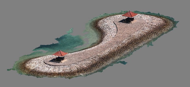
| 3D drone scanned model of stone groin off Sanur, Bali |
Drone Structure Scan - Maritime Infrastructure
Drone structure scan of a stone groin off the coast of Sanur, Bali using a DJI Spark and photogrammetry processing with AgiSoft PhotoScan.
Mission Summary
- Goal: Check out the effectiveness of the DJI Spark for mapping and structure scan, whilst on holiday overseas.
- Tech: DJI Phantom Spark, AgiSoft PhotoScan
- Conditions: Morning, sunny, moderate wind
- Outcome: The DJI Spark is an excellent mapping tool. It is small, light, innocuous, has great range (this island was a good 300m off shore) and a good sensor.
This has been another 'drone adventure' in aerial surveying, inspection and mapping by The Aero Scout.


