 |
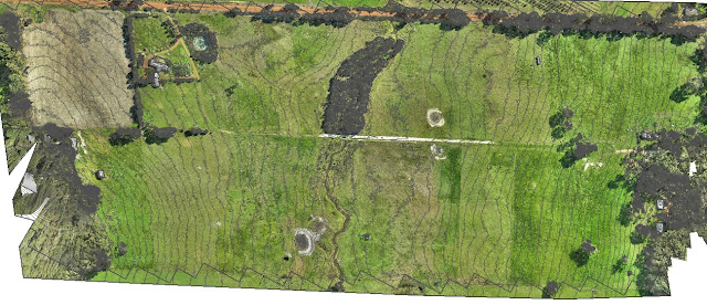
| Contour map of 0.5m intervals created with drone imagery |
Mission Summary
- Goal: To capture drone imagery and demonstrate 0.5m contour lines on a map
- Tech: Skyray fixed wing drone, Canon S100 camera, Tower app, Drone Deploy
- Conditions: Midday, stormy
- Outcome: Producing a detailed contour map, even in difficult weather conditions, was not a problem
For this project I wanted to demonstrate that we could capture drone imagery using the SkyRay in 'marginal' weather and that we could create a map with contour lines at a far greater level of detail than that attainable from satellite imagery.
 |
| Processed map in Drone Deploy showing elevation visualisation |
The second flight was no problems, we adjusted the flight plan slightly in order to get an overlap with the previous flight. Again we managed to finish mapping the entire site before another rain shower came through, all up the entire mission took about 75min including the breaks in between.
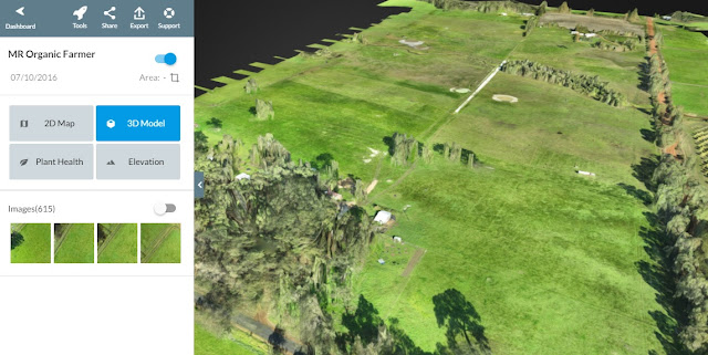
Post-processing was a breeze using Drone Deploy and then small adjustments were made in QGIS to produce the contour lines. With this we were able to deliver a map of the 56 hectare site with 0.5m contour lines overlaid on the orthomosaic. Mission successful.
 |
| 3D view of the 56 hectare farm that's been drone mapped |


