Slider

slide1

Drone Structure Scan - Derelict Cottage

Detailed 3D model of and old derelict cottage in Midvale.

slide2

Small Drone Mapping 101

The Aero Scout shares his experiences with drone mapping and 3D models.

slide3

Arthur River Mt Pleasant Kitchen - 3D drone structure scan

3D model of the heritage building Mt Pleasant Kitchen in Arthur River.

slide4

Chestnut Brae - Farm planning map in Nannup

Demonstrating how drone imagery can be used as a base for effective farm planning.

slide5

Drone Structure Scan - Heritage Lighthouse

Drone structure scan of the heritage South Mole Lighthouse in Fremantle.

Drainage Channel - Asset Monitoring

Photo positions during a drone mission mapping a drainage ditch

Overview

  • Goal:  Using a drone and aerial photogrammetry to demonstrate how a drainage channel can be surveyed quickly and efficiently for monitoring
  • Tech: Walkera Tali H500 hexacopter drone, Gitup Git2, Tower app, Drone Deploy.
  • Conditions: Light winds, cloudy, cool
  • Outcome: Multicopter drones are a very effective way of surveying, monitoring and recording, in both 2D and 3D the current state of the drain. 

Monitoring utility assets such as a storm water runoff drainage channel is time consuming and expensive. You either have to use satellite (or manned aircraft) imagery which suffers from low resolution and 'timeliness' or you have to send a ground team to walk the full length of the asset and make notes.

In theory, with drone imagery and a service such as Drone Deploy, a one man team can be sent to the field to fly and survey the asset at low altitude. This not only yields a current/up-to-date map in high resolution it has the capability to deliver a 3D model as well.

So I thought I'd put it to the test and headed out during a lunch break with my trusty Tali H500 hexacopter with Gitup Git2 action camera to see how well a drone could produce imagery and then create both a 2D and 3D maps in Drone Deploy.


If you can see the map above, click this link to view in new window; View map here.

You can also view a 3D model of the drain below. Click on the viewer, give it a moment to load and then enjoy moving around a virtual 3D model.


The imagery can also be exported from Drone Deploy to other 'more capable' GIS software packages. From there, and with multiple flights over any given period of time, more sophisticated monitoring can be applied.

This has been another 'drone adventure' in aerial surveying, inspection and mapping by The Aero Scout.

Drone Deploy vs Google Earth Pro

Drone Deploy vs Google Earth
A comparison of drone imagery to Google Earth Pro imagery

Mission Summary

  • Goal: To compare Google Earth Pro to Drone Deploy 
  • Tech: Walkera Tali H500 hexacopter drone, Gitup Git2 actioncam, Tower app, Drone Deploy
  • Conditions: Early arvo, Windy, Scattered cloud
  • Outcome:  Drone Deploy gives more features to use on a higher resolution map when compared to Google Earth Pro.

I thought I'd follow up the previous article comparing drone imagery with Google maps with a new comparison of the features in Drone Deploy and Google Earth Pro.

Google Earth Pro recently became a free service and is widely been used as an excellent 'planning tool' for making basic measurements of distance and area based on aerial imagery.

Find below examples of drone imagery I had taken of the shearing shed on the farm turned into a 2D map created with Drone Deploy from a survey I made using my Tali H500 hexacopter with Gitup Git2 action camera. I'll compare this imagery to Google Earth Pro at the same location.

Drone Deploy vs Google Earth
View of the shearing shed from 2D map in Drone Deploy created using drone images.


Drone Deploy vs Google Earth
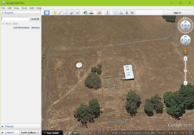
View of the shearing shed from Google Earth Pro, note the level of detail is not the same as drone images above.


Drone Deploy vs Google Earth
One of basic tools is the 'marker' . Add a note of use it to get GPS co-ords of a small point.

Drone Deploy vs Google Earth
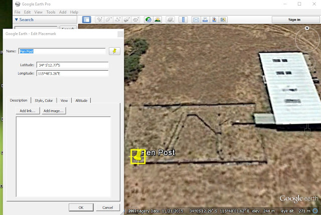
Google Earth Pro's version of the same marker tool. Does the same job, it's just harder to place on a small object.


Drone Deploy vs Google Earth
Measure distance between two or more objects in Drone Deploy 

Drone Deploy vs Google Earth
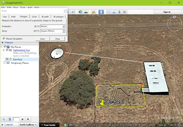
Measure distance between objects in Google Earth Pro


Drone Deploy vs Google Earth
Measure area in Drone Deploy

Drone Deploy vs Google Earth
Measure area in Google Earth Pro

Drone Deploy vs Google Earth
Screen showing multiple annotations in Drone Deploy.
The above are the most basic tools from Drone Deploy and the majority of the tools available in Google Earth Pro. You'll noticed that not only are the drone images used in Drone Deploy are of a higher resolution (meaning you can zoom in closer) but it is also a current map. The drone images were taken only a week ago, I'd say that the Google Earth Pro images would have been taken 6 months ago.

See below for extra features available in Drone Deploy.

Drone Deploy vs Google Earth
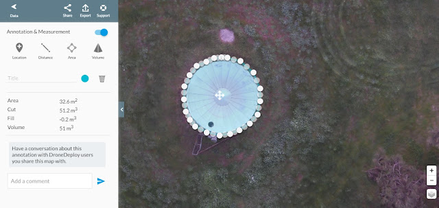
Volumetric tool, not the best example of how to use it but the only applicable one for this mission.

Drone Deploy vs Google Earth
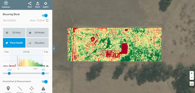
The 'Plant Health' tool (in this example) is based on RGB images and therefore not as sensitive as other methods, but still a useful tool.


Drone Deploy vs Google Earth
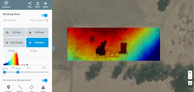
The 'Elevation' tool gives a colour gradient to heights on the map. A contour tool will hopefully be added as a feature sometime soon too.


Drone Deploy vs Google Earth
A 3D model is also generated, great for getting a better understanding of the area mapped.
It's not hard to see that whilst Google Earth Pro has some great 'basic' features, Drone Deploy has many more tools that really turn an online map into a functional planning tool.

This has been another 'drone adventure' in aerial surveying, inspection and mapping by The Aero Scout.

Drone Imagery vs Google Maps

A comparison of drone imagery to Google maps imagery

Mission Summary

  • Goal: To compare Google maps images to drone images 
  • Tech: Walkera Tali H500 hexacopter drone, Gitup Git2 actioncam, Tower app, Drone Deploy
  • Conditions: Early arvo, Windy, Scattered cloud
  • Outcome:  It's easy to see that drone imagery provides higher levels of detail compared to Google imagery.

I've heard the question a few times before; "What's the advantage of using drone (small scale, low altitude aerial imagery) over using Google maps or satellite imagery?"

The other day, I had just finished processing some imagery I had taken of the shearing shed on the farm and it was suddenly very obvious to me that I had the answer to the above question. Below you'll see a series of images of a 2D map created with Drone Deploy from a survey I made using my Tali H500 hexacopter with Gitup Git2 action camera.

Summary screen from Drone Deploy of mapped area and the surrounding area in Google maps

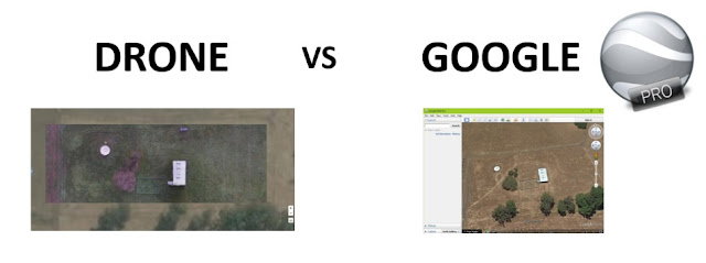
A closer look at the difference in the imagery. Check out the details of the map on the left side.

It's easy to see detail in the shed, pen, parked car, trees and water tank. This was only on half zoom.

The detail from Google maps of the same area around the shearing shed, pen, trees and water tank.
Not all of Google maps imagery is from a satellite, more and more of it is being updated with manned aerial photography, especially in the populous areas. Around the cities resolutions can get around 20cm/pixel but it rural areas this resolution can often drop to around 50cm/pixel. As you can also see from the images above, other major drawback is the 'timeliness' of the imagery. You don't know when it was taken and often Google imagery can be months if not years old.

Drone imagery on the other hand is 'real time', with turn around times of hours or days between taking the images and delivering the map. Also, because drones fly low (under 100m) the detail in the images can be very high (2cm/pixel).

In my next article I'll look at comparing these two sources of aerial maps and how easy it is to use them for a basic 'planning' map.

This has been another 'drone adventure' in aerial surveying, inspection and mapping by The Aero Scout.